FLOW BOULEVARD
Subway Extension and Congestion Elimination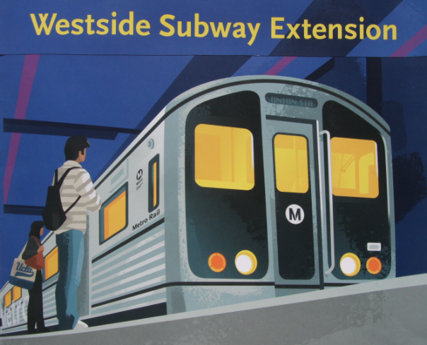
Abstract
This October 2010 statement is a reminder that there does not have to be congestion in the LA Basin. A subway alone will not eliminate congestion by being extended to the Westside; it may very well increase congestion. The point is that there must be multi-modal improvement in such a major transportation corridor that improves both transit and vehicular modes. The issues also involve getting the corridor in the right place so it serves transportation needs well, for making good relationships with adjacent communities to avoid long term impacts and doing it at an affordable non-disruptive pace.
The Metro approved alignment extends westward from the purple line station at Western down Wilshire through a residential district. By this choice a number of poor transportation functions and bottlenecks are permanently put in place. It also sets in motion decades of adjacent community residential impacts that will change the character of the LA Basin. (Comments made in 2010 follow)
Comments on the Westside Subway Extension DEIS/DEIR
By
Phillip Jon Brown, Architect
1864 Benedict Canyon Drive
Beverly Hills, CA 90210
To the Los Angeles County Metropolitan Transportation Authority, Oct 18th, 2010
The short answer to the question of Westside congestion is that a subway alone will not solve it and would certainly not do so in any short period of time. The solution to the congestion is multi-modal in nature needing to improve all vehicular movement as well as to develop transit. The most direct and quickest way to solve for the existing congestion is to greatly improve transit utilizing BRT on exclusive lanes on a one-way pair of streets in the Santa Monica Boulevard corridor connecting the Hollywood area out to the 405 corridor to the west. By connecting BRT transit to the existing (three if needed) Hollywood subway stations there would be a quick extension of transit ridership to the Westside.
It should be noted that the Flow Boulevard concept has been recommended to Metro, presented to the City of Los Angeles, and is being studied by LADOT in an altered form for use in the Pico-Olympic Boulevards study by LADOT. It has also been presented and explained for anyone to see on the World Wide Web at www.FlowBoulevardPlan.com.
The one-way pair of streets, formally known as a Flow Boulevard, would have synchronized traffic signals truly giving bus rapid transit (BRT) “rapid” movement and also improve mobility for cars and trucks. It would take but a year of construction to make the BRT corridor operational. After that stage of transit improvement building up greater ridership, both local and regional, then the subway would justifiably be built if affordable at that time. The initial stage involving multi-modal transportation improvement is, in the short term interest, to quickly solve for the existing congestion and in the long term to establish the subway in the best corridor with multi-modal major transportation status that also reflects good city planning reasoning.
The comments below develop the good “transportation and city planning” combination for the short and long range benefit of Los Angeles. The comments also point out how the Westside Subway Extension study has gotten off track and has made conclusions which would be both bad for transportation and land use planning in the LA Basin area of which the Westside Subway Extension study area is but a part.
Issues of Where, What and When
A subway extension to the Westside of Los Angeles will be a needed transportation benefit to the LA Basin. The issues of concern however revolve around getting the subway into the right transportation corridor with the right compliment of other transportation improvements and to have it occur at the appropriate time in the further development of LA Basin land use and its transportation infrastructure. To be sure, the subway extension represents the development of a major transportation corridor that would affect every other transportation element in the Basin infrastructure and its related land use. To cavalierly omit the issues of multi-modal transportation in the development of a major corridor that would include a subway and to omit associated adjacent “community building and impacts” from the study process in locating the corridor, is to disconnect essential issues of transit service as well as environmental and socio-economic ramifications that can result from such major transportation development. This may be in part that the Los Angeles Department of Transportation and Department of City Planning has deferred responsibilities to Metro creating disconnections of adequate and responsible design criteria. None the less these issues having been omitted must be taken up by someone in authority to avoid major mistakes and impacts. The study is narrow, expedient and does not begin to deal with the short and long term effects which are at issue here involving relationships of transportation and land use and which in reality should affect the development of such a major transportation corridor.
These issues of Where, What and When are poorly considered in the DEIS/DEIR. In fact these planning issues are mainly dismissed by way of a set of assumptions and a choice of a population projection that has been tailor made to fit a subway alone. The dismissal of good and adequate criteria that is to be used in eliminating congestion and to develop good transit violates mandated responsibilities by Metro to be innovative, fiscally responsible and to execute best practices in carrying out duties.
The trouble is that by dismissing good criteria for the study, reality has been sidestepped. And especially a reality that deals with a “future reality” will certainly vary greatly from that confined set of chosen assumptions and criteria that has been made by Metro so far. This severely narrows the study into simply an exercise in engineering guided by a political base and is not reflective of real life issues of dealing with providing improved transportation to commuters, circulation within the Basin for residents and the process of how it may come about. The lack of flexibility and range of consideration regarding variables in the study and the fact that vehicular congestion is essentially dismissed as a subject, purpose and objective to be solved for in planning what would become a major transportation corridor in the LA Basin is not just a matter of inadequate planning. Such a process must be careful to not be an affront to the public trust. Hopefully additions can be made to the program to improve mobility and the elimination of congestion can come about quickly so that the large amount of money that is involved is not spent wastefully, that major impacts due to unintended consequences are not made and that good results may be achieved. To spend eight or more billion dollars and not solve the congestion problem in the LA Basin would prove this study and effort to be a fraud against the people of LA County and the citizens of the LA Basin in particular.
The DEIS Narrows the Study into an Engineering Exercise
Some specific sections of the study that narrow and dismiss reality are the following. Within the DEIS, in the Final Transportation Impacts Technical Report, Parts 1 of 5, section 4.1.4 Peak Hour Roadway Congestion Underlies the Need for Transit; the quick conclusion is that only improving transit is the solution to the entire problem of congestion. In section 4.2.1.4 Programmed Roadway Improvements, the study readily accepts as a limitation that there are no planned roadway improvements in the study area other than the 405 Freeway widening to accept a last HOV lane addition. That improvement is for north-south travel and does not really affect the east-west congestion issue the subway extension study is to address. In section 5.2.2.9 TSM Forecasts and Levels of Service Analysis / Traffic Forecasts it is stated that the only improvement under the TSM Alternative is increased bus service along Wilshire Boulevard, which is obviously no where near to being a serious TSM program to reduce congestion in the corridor. Another study assumption to limit the congestion for a “subway alone resolution” is the nicely fitting population projection. In Part 3 section 5.2 Traffic, it is stated that “by 2035, in the study area population and employment will increase (just) 10% and 12% respectively”. This seems to “fit” a subway with little if any travel demand left over in the study area, but that is emphatically not the case. The basic existing congestion and its further growth are not addressed and would still exist in the future.
So the misleading quick and dirty equation is the following: transit is needed to combat congestion, there will be no roadway improvements and just a few extra buses on Wilshire that will not be enough so that equals a subway down Wilshire. And the supposed confirmation of the equation is that the resultant subway answers the travel demand increase for the target year by being a result of a “low ball” population projection. And there is no mention that the existing congestion in the corridor will be eliminated in the twenty-five years leading to 2035 and that it would really worsen year by year. If that is not a predetermined outcome and obfuscation of the true transportation issue I don’t know what is. The lack of innovative thought and willingness to deal responsibly with the issues is just short of being criminal is my reaction. Sadly it is certainly a result lacking of professional standards, a case of the study being heavily politically manipulated, an inadequate process of the authorities involved and/or some combination of all of the above.
A Subway Alone Will Not Produce the Desired Reduction in Congestion
Unless there is a coordinated plan for eliminating congestion by both roadway improvement techniques (Flow Boulevards for example, to serve resident circulation and commuting by others) along with the proposed very expensive subway that is to primarily serve regional commuting, the communities in the study area will still have the problem of congestion and there will be little money if any left over to remedy congestion having been buried along with the subway development.
Not counting the existing bus ridership that would be transferred to a subway once completed; a subway would absorb about 1/7th of the new increase in trips for the study corridor from 2005 to the target year of 2035 (note; in the original submission to Metro 1/9th was used. Since then a recalculation has been made using Metro’s boardings numbers times 2 to add alightings and the existing deficiency of 55,000 trips for the corridor was included). The “new trips” increase in the study area for east-west person trips that would come about with a 25% increase (less than 1% per year compounded) in the combined population and employment generated trips by 2035. That means that present congestion would not be eliminated. It also means that there will be more congestion in the future if the subway is the only transportation improvement in the corridor. Note for the sake of clarity: (another addition to the original submission is that the total increase from 2005 to 2035 of basin east-west trips (247,600 trips) with the study corridor deficiency trips (of 55,400 trips) makes a total of 303,000 of new 2035 trips to be solved for. Subtracting the Expo Line 27,000 trips and 63,000 trips for a subway, will leave 203,000 trips not accommodated by transportation improvement creating much greater vehicular congestion than today).
A plan to eliminate congestion, and establish what would become a major transportation corridor incorporating the subway, could be quickly begun with BRT (Bus Rapid Transit). Approximately a years time would be all that would be needed to do the necessary construction where Flow Boulevard street improvement techniques, and BRT connections to existing subway stations in Hollywood, could connect the Hollywood area using the Santa Monica Boulevard corridor on out to connect to the existing improved Santa Monica Boulevard at Century City. This would establish the major transportation corridor from Hollywood to the 405 Freeway and as calculations will show below, eliminate congestion with improved conventional vehicular flow as well as the BRT that would extend existing subway travel to the Westside. As further density is developed and further regional travel demand is produced the subway, beginning at the Hollywood/Highland station, would then be readied to serve that additional demand.
In the Wilshire corridor, where a subway would start at the Western Ave Station, a combined major transportation corridor of improved roadway and subway cannot be developed successfully. The roadway portion in the Wilshire corridor cannot be made with continuity through Beverly Hills due to a bottleneck condition made where street widening is unrealistic and parallel streets cannot be incorporated. The Santa Monica Boulevard route through Beverly Hills can be widened and even given improvement with service longevity in the realm of 100 years to serve vehicular modal demands.
Simply put, a major transportation corridor in the study area must be put in the Santa Monica Boulevard corridor or it will create continued transportation and congestion problems along with major land use impacts.
Add Two Major Transportation Corridor Building Improvements to the Program
In order to strengthen the transportation benefit of the Westside Subway Extension and the process of its development, it is not only needed that BRT with exclusive dedicated lanes be combined with the subway corridor, it would be important to have the subway extension reach a point where further BRT travel would be available. The study area corridor and one that it would connect to in the 405 corridor should be programmed to develop BRT as initial and long term support for the Subway extension. These two corridors one east-west and the other north-south have the greatest amount of existing congestion and the greatest amount of trips to be served on the Westside. Both of these corridors need to be linked and a quick establishment of BRT be made to build up rapid transit service in these critical Westside corridors.
Establish a Flow Boulevard with BRT in the Subway Corridor in 1 to 3 Years
The obvious reason for this is to eliminate the traffic congestion in the corridor immediately, not in decades. The operation of BRT brings needed rapid transit to the corridor and confirms that this is the corridor that the subway will be built in. The Flow Boulevard improvement with BRT on exclusive lanes can be constructed in basically just one year of time. The three year time frame assumes that there would probably be two years of talking about it before serious construction of lane re-striping, synchronizing of traffic signals and some curb re-aligning could be made. Effective BRT connections from the existing subway stations to the Flow Boulevard corridor would need to be decided upon. Then community development could then begin with confidence. Designated subway station sites may begin higher density development in preparation of the subway development.
Connect the Westside Subway Extension BRT to a 405 BRT Within 3 Years
A BRT development on a Flow Boulevard used as a “frontage road” to the 405 Freeway solves greater traffic congestion than exists in the Westside Subway Extension (WSE) study area. By connecting the WSE BRT to a 405-Sepulveda/FB BRT the backbone of major Westside transportation improvement is established both east-west and north-south. This brings about “real” rapid transit due to the Flow Boulevard (FB) system of traffic light synchronization and exclusive bus lanes incorporated in the FB (twenty eight miles per hour average along the BRT for buses is a reasonable expectation). A complete copy of the West LA / 405 Corridor Traffic Improvements report dated July 6, 2010 is attached to this electronic (email) submission to Metro concerning these comments on the DEIS.
Metro currently has stated that it wants to develop a BRT connection from the Westwood area to Sherman Oaks in the SF Valley utilizing 405 freeway shoulders as exclusive lanes. By combining that facility with a Sepulveda / Flow Boulevard (Sep/FB) with BRT, that is proposed to run from the Skirball area in the Santa Monica Mountain Sepulveda Pass to Culver City, there would be a quickly developed BRT system going from the San Fernando Valley to Culver City (approximately 14 miles). This kind of north-south major transit facility would raise the ridership of the developing transit capability in the WSE corridor and develop it sooner.
Developing a Major and Complete Transportation Westside Corridor
Comparing the above “conceptual plan” utilizing BRT to enhance and develop a corridor for the Westside Subway Extension, to the subway alone approach, the following will point out the kinds of omissions and/or mistaken reasoning contained in the DEIS/DEIR.
First of all it should be pointed out that the SF Valley connection through the Cahuenga pass would be greatly improved for commuters to the Westside if the subway extension where developed from the Hollywood/Highland Station which would be a direct movement west. A subway extension from Western Avenue station would require Valley commuters to take the red line past the Hollywood station easterly to Vermont, down Vermont to Wilshire then retrace that easterly movement to approximately a Highland street location to then begin westerly movement. Below, it will be pointed out that there is little reason for a regional heavy rail transit facility between the Western Avenue and La Cienega proposed stations in the first place and there would be street and land use impacts there as well if made.
It should also be pointed out that a written request from the West Los Angeles Neighborhood Council has been made months ago to the Metro study team that the Alternative 4 should be given an additional study having the MOS sequence of construction begin at Hollywood/Highland out to the Westwood/VA destination so it can be compared (ridership, costs, etc.) with the existing alternative sequence of starting the MOS at the Western Avenue Station. Is this where the public trust is lost by only giving study to a particular view point?
Existing streets, if correctly positioned and that are basically commercial in land use, can be an underutilized resource for additional transportation capacity to be developed. This is important in developing the Westside Subway Extension into a complete Mulit-modal transportation corridor. A subway in combination with a Flow Boulevard established in the general Santa Monica Boulevard corridor as referred to above would compensate for the deficiency in travel demand capacity that was made when the Beverly Hills Freeway was denied decades ago. This is important to recognize with the fact that such a corridor is with the City for the “duration” and that even further travel demand would be made in Multi-modal terms for which the Flow Boulevard can respond to with staged capacity improvement all the way to being a Continuously Flowing Boulevard; -think 100 years from now-.
Eliminating congestion and improving transportation flow is a benefit to adjacent business and becomes an “organic” growth inducement and improvement to the community. This can best be underscored by the intension and mandate of linking transportation and land use development as stated in California SB 375 which a Flow Boulevard would be in conformance with by having the continuous development opportunity along the corridor being offered. This kind of innovative transportation improvement is what Los Angeles needs if it is to become more energy secure and to reduce Vehicular Miles Traveled as well as eliminate congestion.
To be realistic, transit will always be supplementary to vehicular travel in Los Angeles. This is due to the spatial pattern that Los Angeles has developed. To overcome the vulnerability of Los Angeles to long trips and expensive gas, major corridors such as the one in discussion must be established and quickly developed. Techniques like BRT in a Flow Boulevard configuration should be made part of the Metro Long Range Transportation Plan so that that “in-fill” consolidative development can be made county wide. Long term it is most probable that the electric car will be in abundance on the streets, boulevards and freeways of Los Angeles. As the price of gasoline increases and the California and Federal regulations require greater fossil fuel economy, it will thereby force smaller gas burning engines. The electric car with greater performance characteristics and less cost to operate will be the consumer’s choice to have. The basic transformation of the vehicular fleet of cars and small trucks will change without a doubt. Cars and the roadway they need to run on are with Los Angeles way beyond the foreseeable future. Expect innovation and transformation as a continuous process.
Car-culture and Transit-culture, must be linked together now in our culture, and planned for. With the full spectrum of transportation capabilities the multi-modal corridors can provide the flexibility both economically and technologically that gives Los Angeles stability in providing for our needs.
Getting Good Transportation and City Planning in the WSE Corridor
Once again to come back to the issue of getting the Westside Subway Extension (WSE) in the right corridor must be brought out. The fact that the transportation operation would work better in the Santa Monica Boulevard corridor extending from Hollywood/Highland both short term (with BRT easily and quickly connecting out to the 405) and long term (by having a corridor that can be expanded in capacity and with willing service to higher density land use) should be evident. The Wilshire corridor between Western Avenue and La Cienega has neither of those capabilities. The planning dimension that should be expressed now, and what is so lacking in the DEIS study and the planning so far, is how the WSE transportation facility combines and services the communities it would be put into. A typical transit justification is to find ridership for farebox revenues. The segment of Wilshire which is primarily a low density residential area (much of it with Historic Preservation Overlay Zones), between Western Avenue and La Cienega, does not have or will have ridership to justify a subway. In contrast the segment of the Santa Monica Boulevard, of the WSE alternative 4 study route, has been and it will be in the future, enthusiastic for the development of density. Then the route turns down La Cienega picking up the destinations of what is a regional health services complex which includes the Cedar Sinai Hospital and what is in effect a regional shopping center complex that includes the Beverly Center before the route gets to Wilshire to go through Beverly Hills.
This important planning issue of what the adjacent communities to a subway extension are now and what they should become in the future is basic to building a good city. Most importantly it is about avoiding impacts and negative unintended consequences. Much of these concerns and likely impacts have previously been communicated in scoping comments and a document submitted to Metro dated May 7th, 2009 and entitled Metro Westside Subway Extension Comments. To specifically refer to like concerns again, they may be found on website www.FlowBlvd.com. We are discussing how the WSE benefits or detracts from the lives of hundreds of thousands of people. This is not like engineering a plumbing job to be made.
Study Shows a Flow Boulevard Can Eliminate Congestion in One Year
Using the data from the Los Angeles Regional Transportation Study (LARTS, an admittedly older transportation data base but still relevant and in the Ball Park if adjustments are made) shows that the existing travel demand deficiency in the Westside Subway Extension study area can be solved for with a first stage Flow Boulevard (FB) development with BRT. Again, such a transportation improvement can be constructed in approximately one year. This amount of travel demand can essentially be said to represent the existing transportation capacity deficiency in the corridor and is representative of the amount of traffic making the existing congestion. For a view of the data, it is developed on the FB website at www.FlowBoulevardPlan.com. Click on the menu choice Elements and Travel Demand, then scroll down 1/3 of the way on the page to the section titled Travel Demand and 2030 Assignment.
The transportation analysis shows the data generated from LARTS and a comparison with actual traffic data for 2005 collected by the City of Los Angeles. A projection was made for the overall east-west 2030 travel demand for the entire LA Basin using Fairfax Avenue as the study screenline. Then an Assignment with increased travel demand was made to the Santa Monica Boulevard and Fountain Avenue one-way pair (the SM/FB) which amounted to a 48% increase of person trips over the year 2005 amount or an increase of 35,047 person trips to be added to form the SM/FB witch would total 107,441 person trips. This 35,047 amount is what can be called equal to or greater than the existing corridor capacity deficiency and what is making the existing congestion. And this, the 35,047 person trips, can be accommodated by the improvement of a Flow Boulevard in the Santa Monica Boulevard Corridor thereby eliminating the existing congestion in the Westside Subway Extension study area within just the one year of construction time.
Costs and Timing in Developing the Westside Subway Extension
The Los Angeles Department of Transportation study in estimating the cost of construction for the proposed one-way pair (Flow Boulevard inspired) of Pico and Olympic Boulevards has established that it would cost about $300,000/mile for the re-stripping, traffic signal synchronization, signing and curb adjustments that would need to be made. This was the wrong transportation corridor and one that greatly impacted residential communities in addition, is the reason that project did not go through. Yet here is a source for establishing the basic costs of a Flow Boulevard. When First stage Flow Boulevards become a network and would benefit from connections to freeways and with bridges for passing over freeways, then the average cost per mile goes up. The bridges and ramp rework at the proposed Western-Oxford/FB over the 10 freeway is an example. However in the Sepulveda/FB as a frontage road to the 405 there is hardly a need for any major such construction. Look at the attached 405-FB study to see what improvements may be needed. In the 405 corridor it may take $10 million/mile to establish the Flow Boulevard in that corridor from the Skirball area to Culver City some 8 miles. Yet adding an additional six miles to Sherman Oaks as proposed by Metro with exclusive lanes for BRT on the freeway shoulders, the average cost/mile for establishing BRT from Sherman Oaks to Culver would be something like $6 million /mile (then a 14 mile facility).
The Santa Monica Boulevard (SMB) corridor, utilizing Fountain as the primary paired street yet not pairing with another street between La Cienega and where it connects to the existing improved section of SMB at Century City (along with just making way for three lanes in each direction); could be somewhere between the $300,000 and $4 million per mile cost. For discussion purpose, say an average of about $2 million/mile. A subway is in the $500 million/mile price range. And for a conservative comparison let’s raise the average cost of FB construction per mile to $10 million for an average over the LA Basin. A half mile of subway cost could build 25 miles of Flow Boulevard around the LA Basin. Add another half mile of subway cost and that gives $250 million to buy new buses with and you have a BRT and improved street system that eliminates congestion in from 1 to 3 years (possibly if the planning can get behind it).
Roger Snoble, the former chief executive for Metro made an interesting prediction regarding subway timing. In what the LA Times reported (12-22-08) as a “telling moment” at a news conference celebrating the passage of Measure R; Snoble told reporters that the so-called Subway to the Sea would take decades to be built, causing Los Angeles Mayor Antonio Villaraigosa –its primary proponent- to quickly step in and insist it would not take that long.
Well here we have an experienced transportation chief executive who ran Metro for seven years with one view very different from a representative of political views with a very different slant. Possibly the Mayor was elated that a new source of funding had come about, but this is really before our recent “Great Recession” really has taken hold. Now there needs to be careful dollar stretching approaches made in spending of any public moneys. Public money is scarce and needs to go to where it has the greatest socio-economic and in this case greatest transportation problem solving ability and stimulative effect.
Embrace Many Communities with Fundamentals of Growth and Job Making
A way to have greater economic stimulative effect with transportation, in this great recession, is to start overcoming some of the perverse business and livability conditions in Los Angeles that “sprawl” has largely fostered. This would be done on a broad range by encompassing as many communities as feasible with a growth pattern of consolidation.
The situation also requires the ”reinvention” of our economy or transitioning to a new economy if you will. Sprawl has made Los Angeles spend wildly in resources and time, separating further places where we live, work, spend time at play and educate. Now it is evident that vulnerability has come about that threatens how the Cities and County functions. The vulnerability emerges in that expensive gasoline, housing to far from work, infrastructure too costly to extend and maintain, and negative environmental consequences emerge all making the economic “fixes” of sprawl no longer workable because they are unaffordable.
The high unemployment, high taxes, high amount of congestion, high VMT per capita, low educational scores, low income, low expectations and anti- business climate can be reversed with the new economy. Looking at the small scale and starting with existing communities by solving congestion and cut-through traffic; people and business friendly desirable places to live in revive existing business, bring entrepreneurs to invest, create jobs, as well as new housing and businesses close-in to adjacent work centers.
The more cities, communities and neighborhoods that receive that boost, the more the effect occurs at the large scale and the new economy strengthens. An extensive network involving many areas of LA County by utilizing low cost Flow Boulevards that are integral with existing land use development allows it to take place.
This process cannot begin with expensive heavy or light rail because with subway not much can be built and with light rail the route though less expensive than tunneling are usually in corridors outside of the existing developed areas in unused old Railroad right of ways. The very expensive rail transit scenario also involves costly high or medium rise new development around stations. These would not come about any time soon given 20% vacancy factor for well located offices. Nor would high rise residential locate there. Rail lines are for commuters to come in from the suburbs to work, not the other way around. This is confirmed on already constructed rail lines like the Blue Line; where are the communities and the development?
Metro is bound up in sprawl producing transportation facilities and has still not added a transportation improvement element that is designed to promote densely developed transportation corridors, eliminate congestion and is widely affordable in the urban context. Metro should add the Flow Boulevard concept to the Metro Long Range Transportation Plan and begin this obvious oversight by constructing Flow Boulevards with BRT in the Westside Subway Extension corridor and the 405 freeway corridor as a frontage road. This would begin the necessary transportation problem solving that the Cities of LA County need to consolidate, stabilize and provide the growth needed by a new economy (more on the idea of a new economy is stated on the website www.FlowBoulevardPlan.com, in the menu selection FB 2010, starting on page two, New Economy).
References to Earlier Expressed Transportation and Land Use Relationships
It is important to pointing out that the Westside Subway Extension study has left serious city planning issues unaddressed. These issues are critical to the success of the subway extension and to the function of transportation and land use in the LA Basin.
The references are in previous scoping comments and on the Flow Boulevard website. The more fully developed reasoning is made on the FB website at www.FlowBlvd.com, (you will note there are two addresses for the site).
Serve and Protect: This concerns the basic transportation and land use issue that unites the major transportation corridors with the geographical and traditional transportation corridors of the LA Basin. As one moves west in the northerly portion of the Basin the street grid becomes cut off by the Santa Monica Mountains. The traditional major corridor that collects the streets that get cut off is Santa Monica Boulevard which coincidently was partially pioneered as a Pacific Electric Trolley line (transit), as well. The southerly traditional major corridor is the Venice corridor and it too had trolley history in its background. What developed through time was a central residential area between these two east-west corridors.
It was Gaylord Wilshire that in 1895 donated to the city a path through what was then a barley field on the condition that the Boulevard would be named after him and that a railroad line, as well as commercial and industrial trucking would be banned from that corridor. Other than residential, the commercial land use that has come about mainly has been to serve the residential communities that built up there.
The central primarily residential land use, and much of its character, should remain as it is. This is particularly so in the area between Western Avenue and La Cienega. To do otherwise with the promotion of regional office use by the inducement of the regional transportation facility of a subway is to bring major disruption of street widening and land use changes to the area. That area should refine its residential function and serve the regional work centers that surround it. The failure for the Miracle Mile area, within that stretch of Wilshire proves that regional land use has moved on to what is known as a polynodal pattern of much larger proportions. The impulse to send a subway down this stretch can be purely predicated as a short term real estate ploy with little worth and much impact in an area that is a unique feature in American Cities; residential communities surrounded by a Downtown and many existing work centers. To break that land use form is to diminish the value and function of both the central residential areas and the surrounding employment centers.
Likewise, to put a subway into an area that cannot justify ridership is wasteful. That opportunity should occur in a corridor that can and would want to be developed with regional attracting land use. But the residential between Western and La Cienega would not be good for regional office space and supporting multi-modal transportation is elusive. Functionally the street pattern on Wilshire, which would be necessary to support multi-modal transportation, gridlocks on the easterly Downtown end and continuity to the west fails by a bottleneck in the Beverly Hills end. The Downtown end can be dealt with to the benefit of Wilshire Center by introducing a one-way couplet of Wilshire and Sixth Street. No such luck on the end which approaches Beverly Hills where a couplet gets separated and diffused into little streets. No chance to flow west as a major corridor or make a turn into the SMB corridor eventually connecting to communities near the 405. Regarding extending a subway from the Western Avenue station, the Wilshire corridor does not work, whereas extending the subway from the Hollywood/Highland station will work in the Santa Monica Boulevard through Beverly Hills and extend to the 405 corridor.
Path to Website of Previously Expressed Relationships
To observe the Flow Boulevard Loop Plan, of which the selected Westside Subway Extension is placed in the Santa Monica Boulevard corridor, and read further on land use with transportation relationships; go to the website www.FlowBlvd.com.
Then the particular section of the website is reached by clicking on menu item Basin Loop/Corridor Study, then read and scroll to the Serve and Protect segment with several others down to a funding section which shows that Flow Boulevards “pay their own way” through property taxes and fees, then down to where the east, south and west sides of the Loop are referenced. The northern FB, Santa Monica Corridor Study, is on page two of the Basin Loop/Corridor Study, which allows a preliminary plan view of the corridor in more detail. And again, the study, West LA / 405 Corridor Traffic Improvements is attached in this email submission. Since attachments sometimes have a way of getting separated or not able to be filed together with the direct email text, the study will be emailed separately as well.
The Santa Monica Corridor is the correct corridor to establish the Westside Subway Extension within by incorporating a Flow Boulevard with BRT as a first stage of building up what would remain as a Major Westside Multi-modal Transportation corridor for the Westside.